Let architect Thom Brisco take you on a 100-mile tour of landscapes colonised by the Romans, settled by the Saxons, and raided by the Vikings, then fortified by the Normans and drained by the Dutch
This story is the first of our Trails series. We invited people to apply to assemble a group of friends and walk a multi-day trail of Slow Ways. They could submit the story of their adventure in whatever form they liked.
Smart prep for our walk from Colchester to Norwich might have involved me and my partner Pandora going on a few short warm-up hikes, but I swapped that out to trawl a couple-hundred wikipedia pages about Vikings. Reading how our path through Essex, Suffolk, and Norfolk would cross the former Kingdom of East Anglia, long-ago settled by Scandinavians to form the Danelaw, I thought it’d be fun to invite our Nordic mates Tiril and Adrian. A chance to show them where they might have grown up, had their ancestors joined the Great Heathen Army.
Finishing up work on a Thursday, and due back at my desk by Tuesday, we had four days to cover the 91 miles of the planned route. However, by casually combining the booking of off-trail accommodation with the addition of short sight-seeing digressions, I managed to bump it up to 100 miles. Implausibly, back then, 25 miles per day sounded like a breeze.
Day one
Jumping off the train at Colchester, my insistence that we bend our route to enter this former Roman capital through its surviving gateway, before visiting its water tower, ruined priory, and concrete mural, ensured that we had walked for at least two miles before reaching our scheduled start point. Stocked with snacks and blister prevention tape, we set off northward, crossing the river Colne and climbing to High Woods Country Park where small streams lace through the roots of the woodland.
An hour later we experienced one of the more surreal memories of our walk when we turned out of green fields into the battered moonscape of an aggregate quarry. After crossing a ridge between two flooded pits, we reached an active portion where machines were digging great trenches through the footpath, and we were forced to scramble our way out toward the village of Ardleigh.


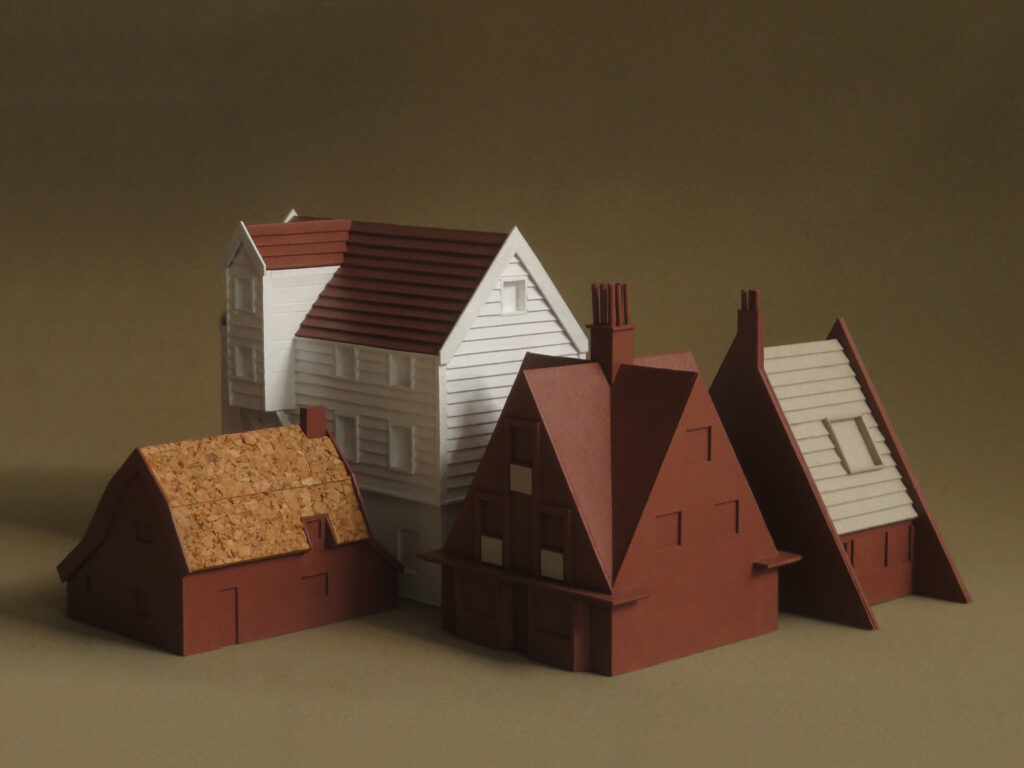
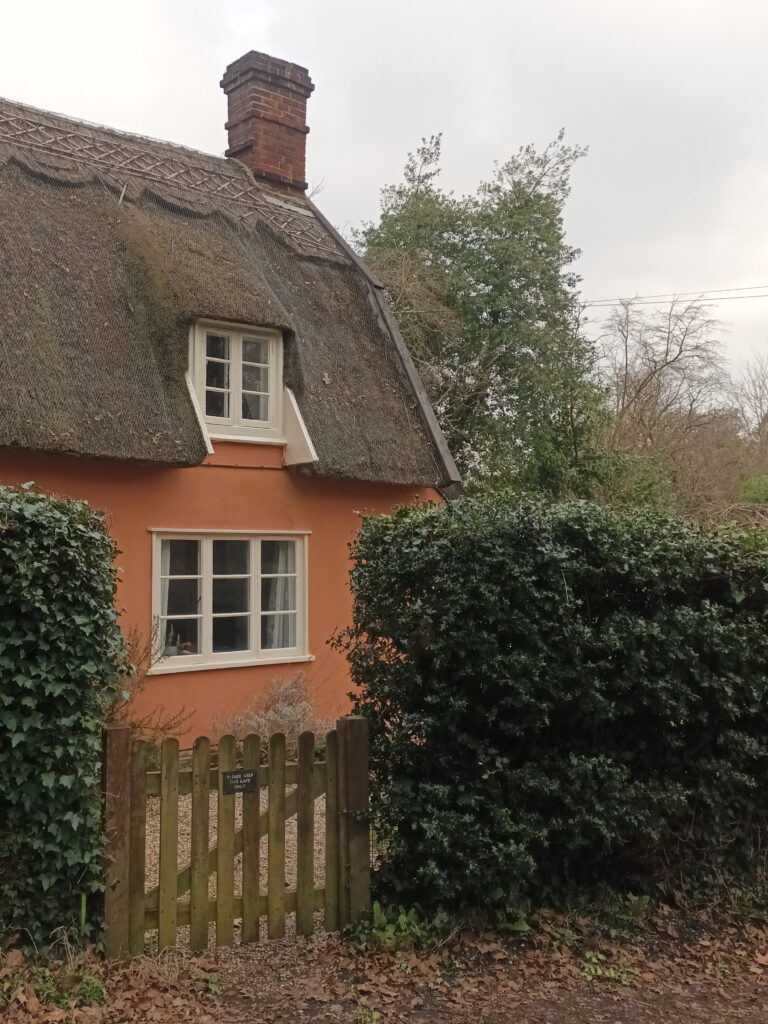
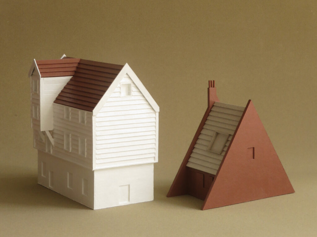
On the approach to Manningtree we were skirting the edges of a village called Lawford when one of my debatable detours brought us to the door of a beautiful cottage that I knew right away would become the first of the buildings that I planned to make a small model of, as a record of our trip. Located on Church Hill, ‘Pink Cottage’ is an 18thC-built house with a thatched roof and small lean-to, roofed in pantiles. With its pink plaster, white window frames, and patterned thatching, it is the kind of gingerbread house that you might picture when thinking of the British countryside and yet the gambrel roof and pantiles connect this cottage to the Low Countries. Imported from the Netherlands since the early-17thC, pantiles form a bright terracotta stripe across these eastern regions, highlighting longstanding ties with Europe.
When working on the conversion of a late 18thC-built threshing barn a few miles up the road, a local heritage consultant once shared with me how the near 250-year-old roof timbers looked likely to be imports from the Baltic Countries.

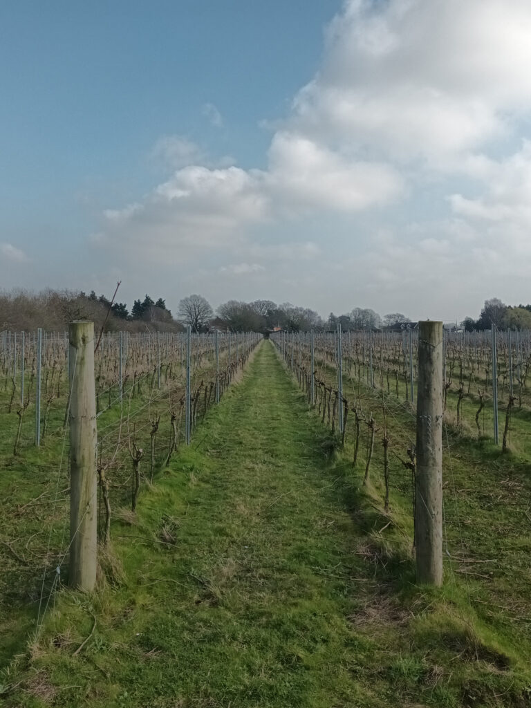
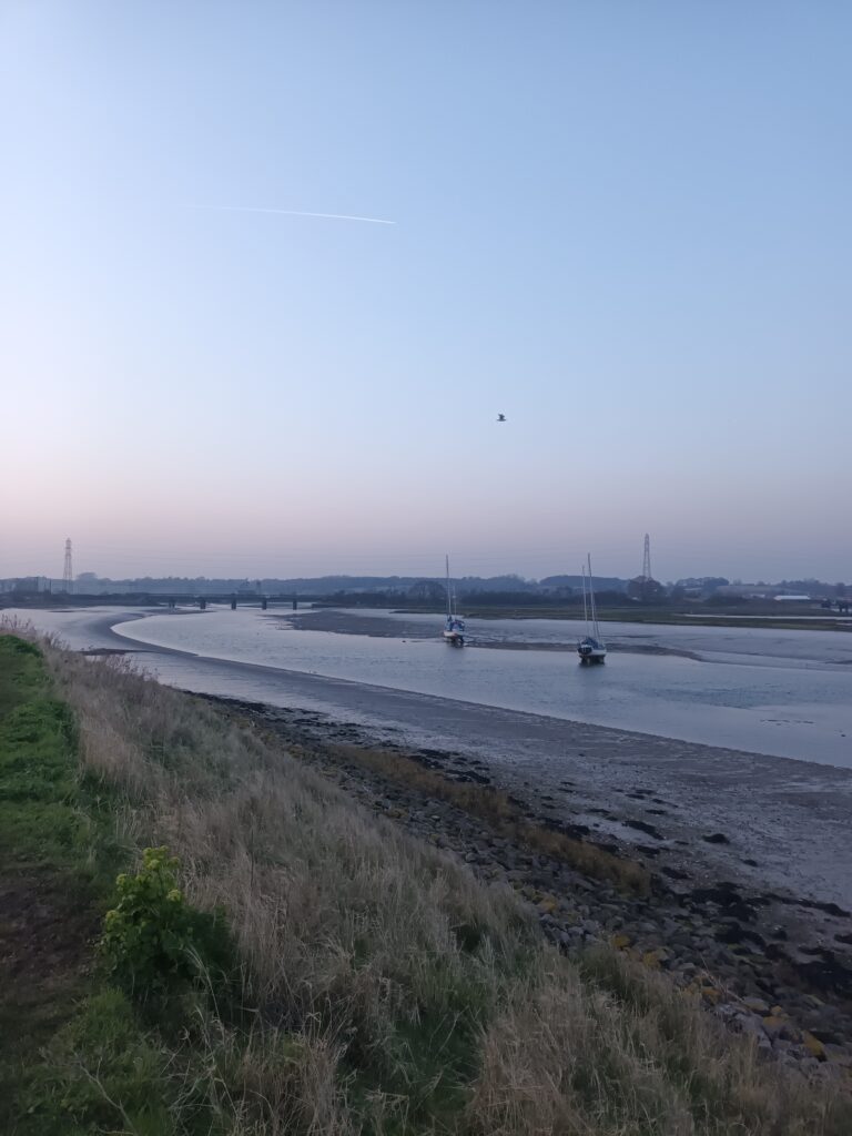
Across the afternoon we passed a vineyard called ‘Prettyfields’ and a farm with a tall green silo marked ‘Boythorpe Cropstore’ before we arrived at the glassy estuary of the river Stour. Looking out to the Shotley Peninsula, I shared with our Viking pair how a local detectorist had recently found a comb made of reindeer antler that is thought to have been brought to the area from Norway in the 9thC. The lateness of our subsequent ‘lunch’ continued to uncover the naiveté of my planned daily mileage, but we set out determined to complete our march into Ipswich with the sun already low in the sky. We crossed the river Orwell to enter the city at half-ten that night.

Day two
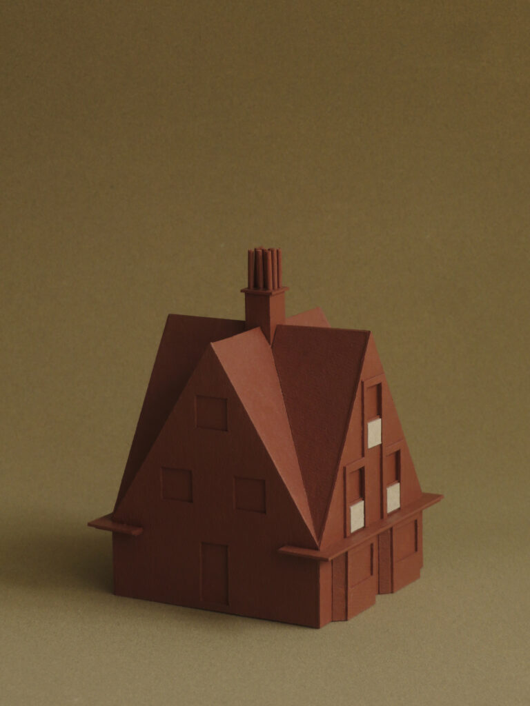
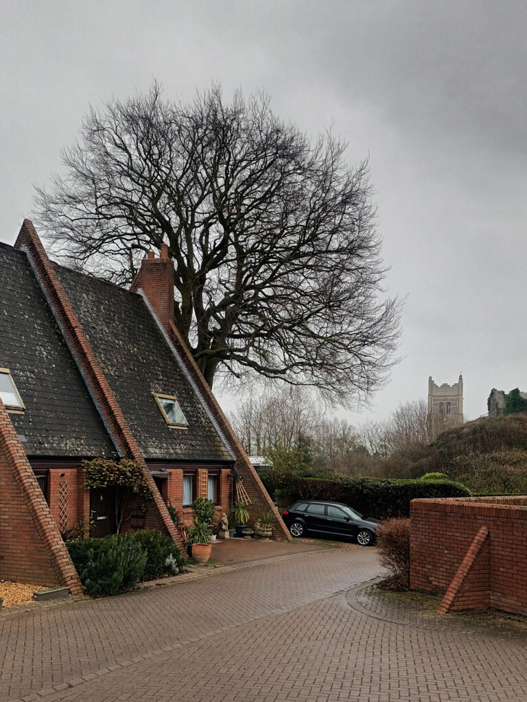
After eight hours of sleep in an eight-square-metre room, we gobbled beans on toast from Audrey’s Café, before beginning to hobble out of Ipswich along the near thousand-house-long Norwich Road. Beginning to feel human again as we passed the low-200s, I looked up at Number 274 to encounter an especially handsome house with steeply pitched roofs and a perfectly triangular gable, built in red brick and clay tile.
I’ve since found out that the house was designed by the architect Arnold B Mitchell and built in 1912 as the winner of an ‘Ideal Villa’ competition run by a national newspaper. The model reveals the square plan of the house and how all four elevations share the basic symmetry of the street front.

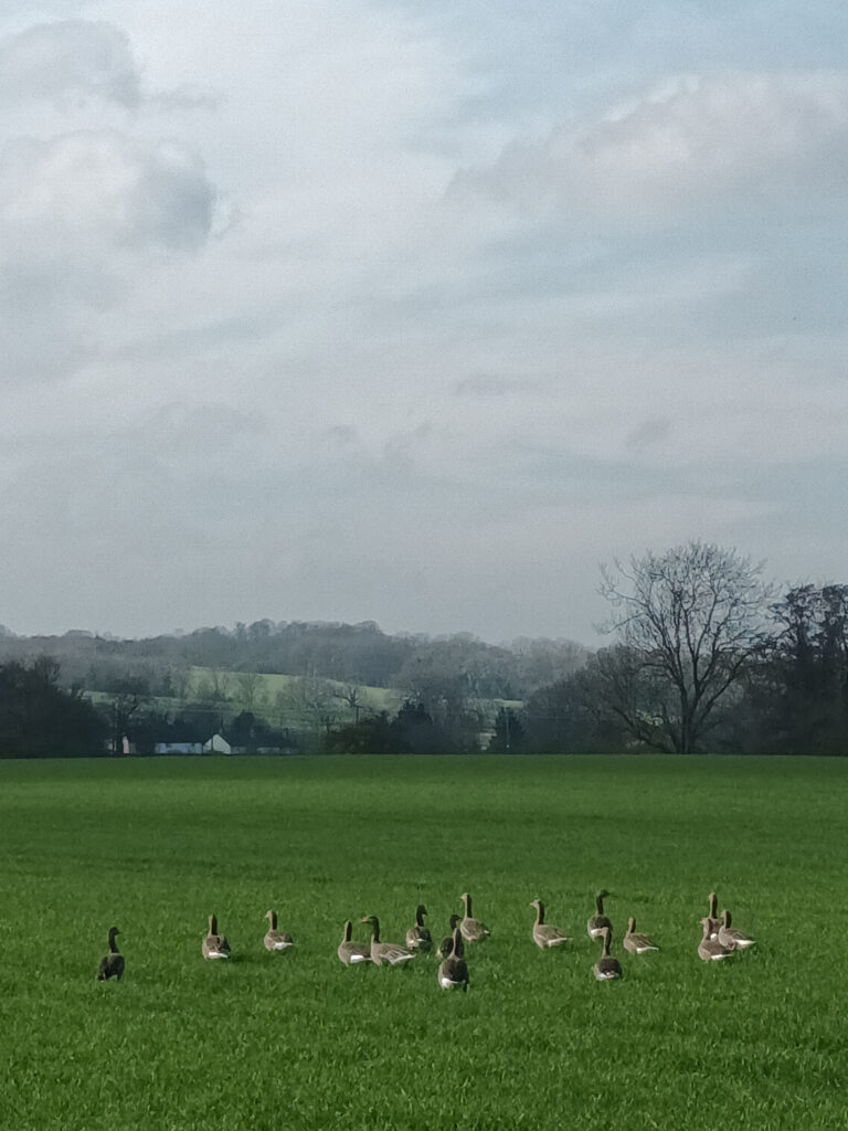
Leaving the asphalt behind, we stepped off road at the village of Claydon to follow for several miles the course of the River Gipping. Flanked by fields, ponds, and woodland, this winding riverside path was a highly enjoyable leg of the route with information boards that extended the story of the region’s relationship with Europe. Describing its lost navigability, we learned how the river brought Danes to settle the area in the 860s and how, in the 11thC, the river was used to transport limestone from Normandy. Nestled in one of the course’s wider meanders is the Baylham Rare Breeds Farm, where the west bank’s gaggles of grazing geese were outdone by the bellowing beasts of the east bank.


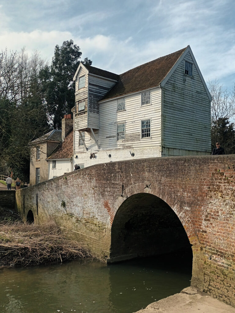
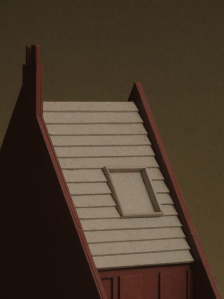
It was a couple of miles south of Needham Market that I came across the third building that I have modelled. Attached to a small older house, the listed Baylham Watermill was built in the early 19thC and sits close beside a bridge over the river Gipping. Characterised by the white-wash of its brick and timber-boarded storeys, the clay roof tiles, and diagonally braced hoist tower, the mill’s striking presence in the open landscape appears to be exaggerated by the rising swell of the bridge.

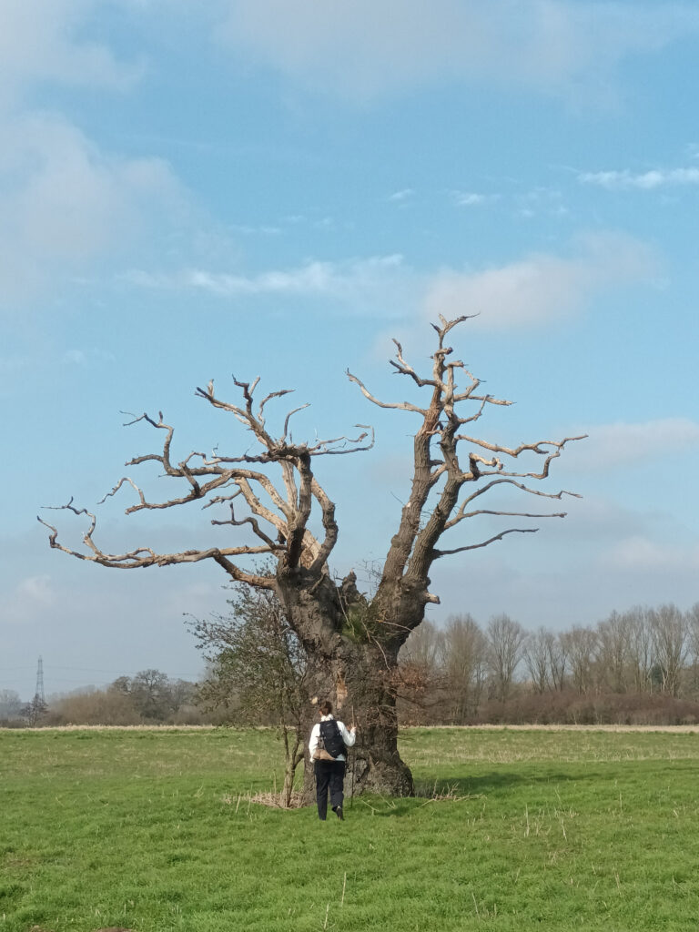
As the afternoon progressed, we grabbed tea at Needham Market, pancakes at Stowmarket, and snacks on route to Stowupland, passing a series of curious landmarks that included an obviously magical tree, the great industrial workings of Munton’s maltings, and a bus-sized turnip pile. Arriving fifteen minutes before the bar of our inn was set to shut for the night, the pint that followed tasted all the better for the three-mile digression from our route, that I’d so nonchalantly added when picking accommodation.


Day three
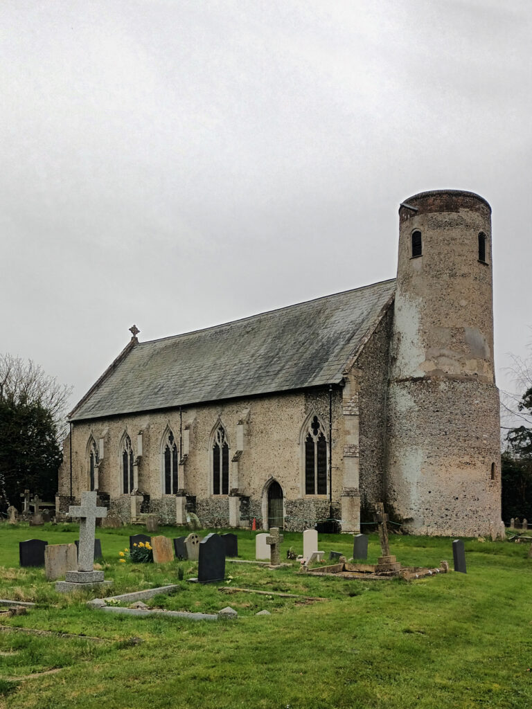
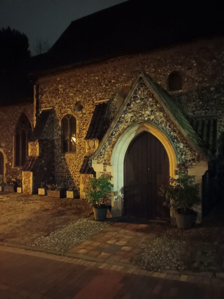
With breakfast warming our insides, and blister tape much of our outsides, we set off to rejoin our trail at a halfway point on its length. It was a wet morning of puddles and mud that slowed our pace and dampened our spirits but there were relieving sights ahead in the small market town of Eye. Entering from the west, we circled the footprint of its central motte-and-bailey castle, climbing to its peak through the ruins of the keep, windmill, and folly that had crowned it across the past thousand years. From the top we looked east to the town’s towering flint-faced church where, shortly after, Adrian would unpack his Norwegian goat horn to improvise a piece amongst the pews and the incense, a strange reunion of medieval Nordic paganism and Christendom.


To the west of the castle mound we could see the ring of the historical bailey where, built by the council at the beginning of the 1980s, is the Castle Hill housing estate. Designed as a ring of short curving terraces, these council houses have red brick party walls that extend beyond their door line to form buttresses, like the walls of the castle they neighbour. They are endearing, comically triangular, homes with chimney pots, slate roofs, and individually carved door hoods, that have clustered together to shelter their community of Eyelanders for almost fifty years.

Day four
Closing the door on the swimming pool and steam room that we had been too tired to use, we set about our recovery from the previous day’s marathon by walking another one. Having bridged Palgrave, Diss, and Burston the night before, the walk ahead crossed several miles of open fields peppered with pylons, thatched cottages, and round-towered churches. Approaching the village of Wacton, we looked up from our stile and mud-hopping feet, to find ourselves surrounded by a gang of five edgy-looking horses. Delicately counselled by Tiril’s Norwegian whispers, they nudged us across their field, and out the other side through the hedgerow. Of course, we’d then have to repeat the trip twice over, as Pandora had dropped her phone at the stile. Arriving with our bodies in bits, we were put back together by staff at the sympathetically named ‘Huggers’ who cooked up a big vegan lunch at their Long Stratton café.

At three o’clock we began the final leg of our crawl, leaving town to turn into green fields and verdant woodland. We chatted to horses at a sanctuary near Flordon, and heard peacocks calling on the common at Mulbarton, before collapsing into the less encouragingly named ‘World’s End’ pub for a pint. By then, we were just seven miles out from our finish line so, after a change of socks, we strapped on our headtorches and set out for the glow on the horizon. Around ten o’clock we completed the climb up into Norwich, passing St Julian’s Church and the Dragon Hall of King Street before crossing the river Yare and crumbling beside the doors of the station.

Colonised by the Romans, settled by the Saxons, and raided by the Vikings, then fortified by the Normans and drained by the Dutch, the East Anglian lands of our walk are populated by structures built with material from the Netherlands, France, and the Baltic. Once joined to the Low Countries by the submerged hills of Doggerland and bridged to Scandinavia by the great northern ice sheets, the landscape of our Anglo-Nordic walk remains a product of its proximity to the continent. Told through this text, the models, and photographs, I hope you have enjoyed these tales and their small part in a wider European story.


Thom Brisco is an architect based in London and university tutor at the Kingston School of Art.
He runs Brisco Loran architects with his partner Pandora.
Their work together can be viewed at briscoloran.com or @briscoloranarc on Instagram.